Improvements to Bishop's Bridge Road
A public realm action plan has been drawn up for Paddington’s Bishop’s Bridge Road, to address severance and make it safer for all users. Commissioned in February 2021, the action plan contains a wide range of ideas to tackle severance between Paddington Station and the surrounding Paddington Opportunity Area, centred on Bishop’s Bridge Road, between Eastbourne Terrace and Harrow Road.
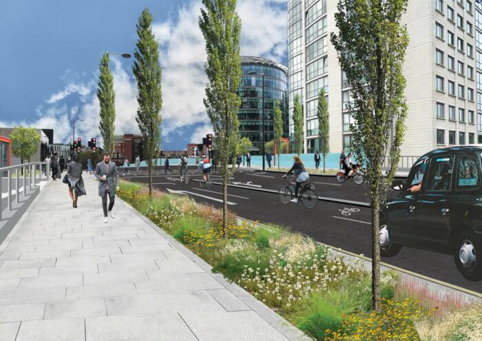
The objective is to creare a safer and more welcoming street layout, improved access for pedestrians and cyclists, enhanced pedestrian crossings, and better wayfinding to help residents, businesses and visitors to the Paddington area.
Bishop’s Bridge Broad presents a barrier to pedestrian movement. Whereas a new pedestrian crossing has been commissioned at the Eastbourne Terrace end, the remaining three crossing points on the bridge frustrate pedestrian users, hamper access to bus stops and Paddington’s waterspace and have been identified by people who live and work locally as needing review.
Consultation Report
A consultation website went live in July and closed at the end of December 2022, where anyone could give their views, and any other ideas to improve Bishop's Bridge Road. You can read the full consultation report here.
The study, funded by Neighbourhood Community Infrastructure Levy (CIL) through the Hyde Park Paddington Forum, dovetails with the emerging North Paddington Vision led by WCC’s Place-shaping team and is an extension to the City Council’s Paddington Places work. The ideas have been generated through extensive discussions with Westminster City Council, Network Rail, Canal and River Trust, Transport for London, Marylebone Boys' School and members of The Paddington Partnership.
About Bishop's Bridge
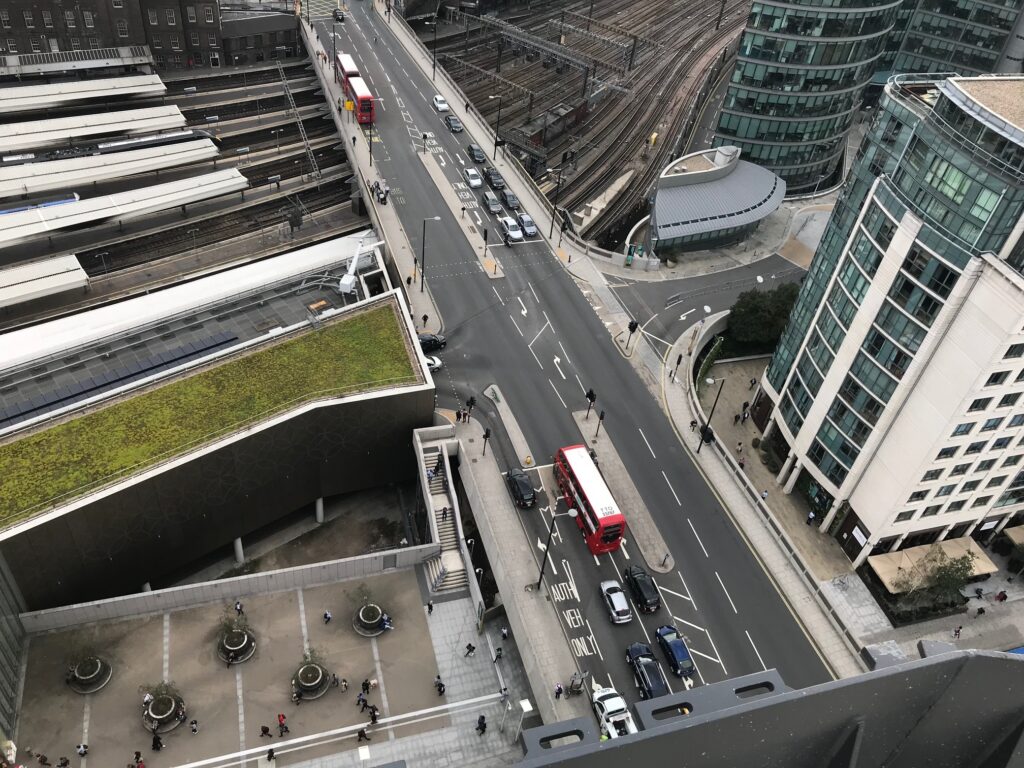
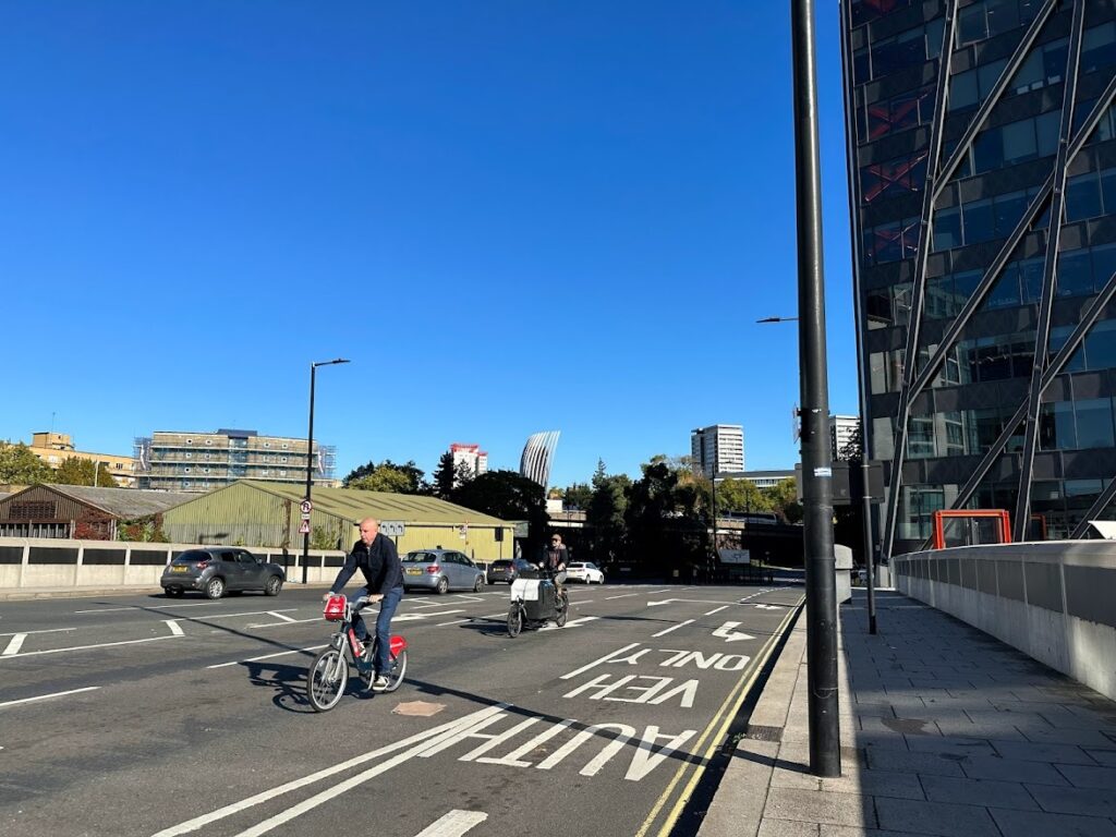
The A4206 Bishop’s Bridge Road is a two-way road with two lanes in both eastbound and westbound directions. It is a strategic traffic route linking Westway and Harrow Road to the east and Westbourne Grove to the east, and carries over 10,000 vehicles, including over 500 HGVs, per day. As a strategic route, the road is dominated by high volumes of vehicular through-traffic including taxis gaining access to the Paddington Station taxi facility.
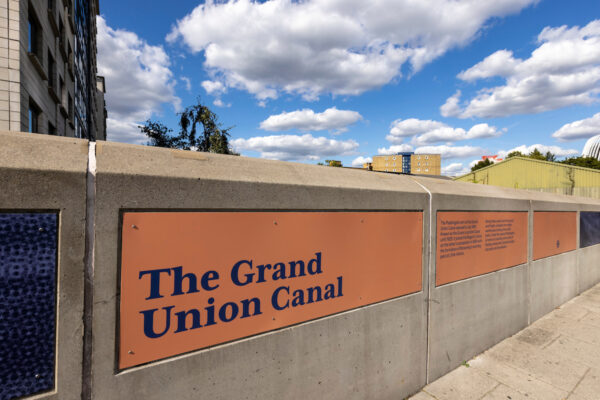
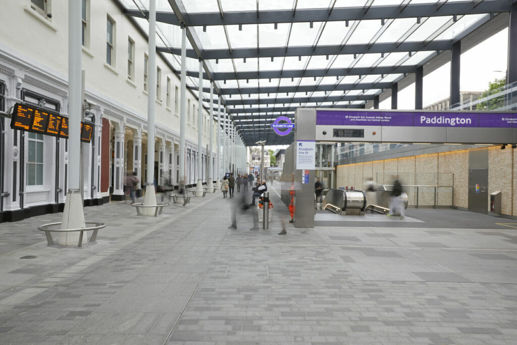
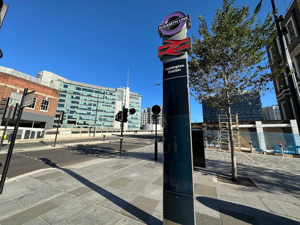
The road also carries buses, as well as providing a key cycling corridor for over 500 cyclists per day. The road lies to the north of Paddington Station, a major transport hub for both London and national journeys, and is now an operating Elizabeth line station, generating considerable growth in the number of visitors and commuters in the area. The site is located within the Paddington Opportunity Area and neighbours a number of notable local landmarks, including Grade I listed Paddington Station, the Brunel Building, Sheldon Square, and the Paddington Arm of the Grand Union Canal, which attracts tens of thousands of visitors to the canalside every year.
Bishop’s Bridge Road dissects Paddington. Over 1,200 homes are within one minute’s walk of Bishop’s Bridge Road, alongside just under 2.5 million sq. ft of office space. Pupils and students attend a number of schools and colleges, including Marylebone Boys’ School, Westminster Academy, City of Westminster College, Hallfield Primary School, Phileas Fox Nursery and L’Ecole Bilingue Elementary.
Over 25,000 people work in Paddington, spread across a broad range of sectors including financial, engineering, pharmaceutical, retail, technology, telecommunications, life sciences, transport, sport, music and media. The area is undergoing significant transformation and in the Opportunity Area development pipeline alone, a further 1.4 million sq. ft of office space is planned, plus a further 1,200 hotel rooms. Footfall is forecast to increase further once more developments are completed and the Elizabeth line is fully operational as a through service.
What is the history of Bishop’s Bridge Road?
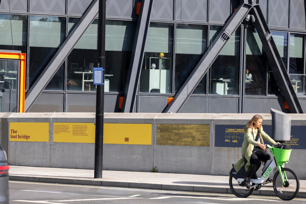
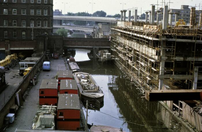
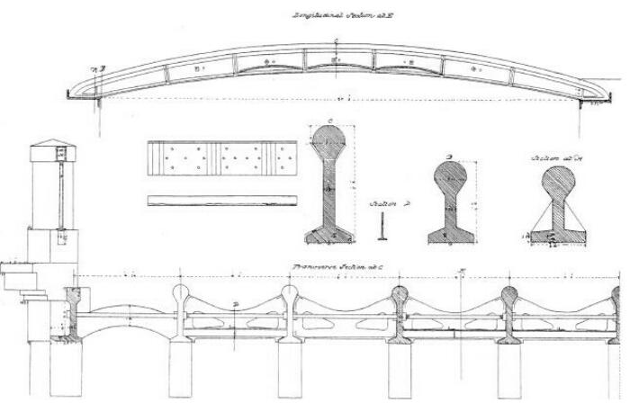
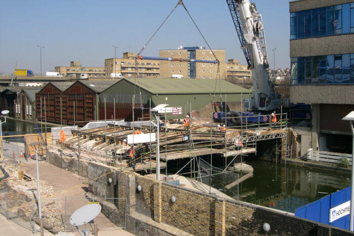
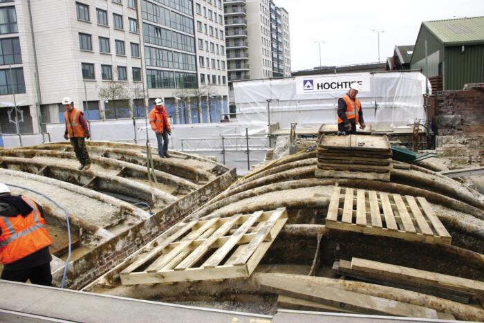
Bishop’s Bridge Road in its current form was opened in 2006. A project by Westminster Council had seen the replacement of previous structures over the canal and the railway. As the project was about to start, a 19th-century iron bridge designed by Isambard Kingdom Brunel was discovered buried within the brickwork spanning the canal. Built in 1838, Brunel’s bridge was designed without bolts, locking like a jigsaw, with bulb-headed cast iron girders, hidden for almost a century. The dismantled bridge remains in the care of English Heritage, in storage near Portsmouth. In a nod to this remarkable discovery, and Paddington’s heritage, proposals for improving today’s Bishop’s Bridge Road could potentially incorporate engineering or artistic references to Brunel’s original bridge over the canal.
What is wrong with Bishop’s Bridge Road?
A combination of factors make Bishop’s Bridge Road an unwelcoming and challenging route for both pedestrians and cyclists. It is difficult to cross, lacks a sense of local identity and is characterised by its uncomfortable hard landscape.
Similarly, other bridges around the Paddington basin have more character, feel safer, are brighter and easier to navigate, and better reflect their local context. This is something we are keen to recreate as part of our approach to better connect Bishop’s Bridge Road with the surrounding area and its landmarks, including the Paddington Station façade, the canalside, the Paddington Central campus, and the newly opened Elizabeth Line Station.
The Paddington Partnership believe there is an opportunity to address the site’s lack of identity and several inherent issues with the streetscape as part of their ideas for the future of Bishop’s Bridge Road. These issues include:
- Poor Wayfinding: The site currently lacks appropriate signage to aid wayfinding toward the canalside and Paddington Station, both the mainline and Elizabeth line station
- Congested: The coach stop and taxi queuing area located on bridge causes congestion and contributes to the poor air quality.
- Lack of biodiversity: The space is currently dominated by hard landscaping and lacks urban greening
- Vehicle Dominant: The bridge is currently dominated by space for motorised vehicles and fails to provide suitable space for pedestrians and cyclists
- Crossing locations: The current location of the crossing into Paddington Central is located away from pedestrian desire lines
- Footways: The existing footpaths are cluttered and cause pinch points for those walking across the bridge


Pedestrian and Cycle Movement Survey
In Spring 2022, The Paddington Partnership commissioned NRP to undertake a pedestrian movement survey to gain a greater understanding of pedestrian and cycle movements on and around Bishop’s Bridge Road.
The study also explored the extent of footway crowding adjacent to the coach and bus stops on the southern side of the street where there are often a number of obstructions.
The study indicated extensive crossing at informal crossing points, and higher than average levels of crossing on the ‘red man’ at controlled crossings.
The study identified that crossing demand at these uncontrolled locations makes up, in total, around 20-25% of the total volume of people crossing Bishop’s Bridge Road in the vicinity of the access junction. Therefore given the proximity to various schools, public transport facilities and new developments, there is a strong case for providing improved crossing facilities.
The traffic surveys showed that peak hour cycle flows are around 20-30 cyclists per hour in each direction, with cyclists mixing with general traffic, including HGVs, buses and coaches. The total two-way traffic flow in the peak hours is up to 1,500 vehicles per hour, and the proportion of HGVs/buses/coaches can exceed 5%. When considering guidance set out in DfT LTN 1/20 Cycle infrastructure design, TfL London Cycle Design Standards and the TfL New cycle route quality criteria, these high traffic values warrant consideration of some form of segregated cycle facility.
The study also considered footway width and pavement clutter. The effective footway width is below standard at several locations, with multiple examples of poorly located street furniture, which make it sensitive to congestion and low levels of pedestrian comfort particularly around the coach stops.
The lack of cycling facilities is out of step with current thinking, pavements are cluttered with redundant signage and poles, and the coach stop can result in blocked pavements.


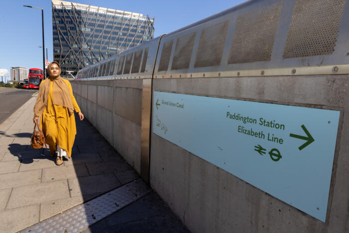
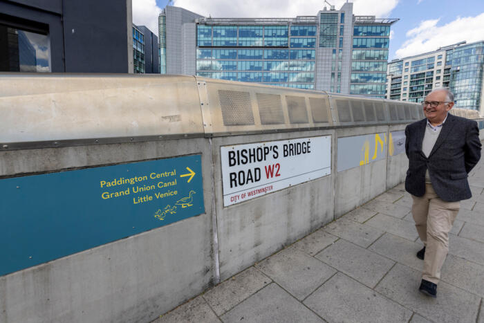
Wayfinding
Wayfinding is poor, surfaces tired and there is a lack of contrast in terms of colour, character and green infrastructure.


Canalside amenities hidden from view
Sightlines from the bridge are poor, with little indication that Paddington Station or the waterspace lie below. The bridge hides from view the many canalside assets and amenities on offer. It is often unclear how to access Paddington Station from Bishop's Bridge, with users passing the crossing before realising there are steps to the canalside.


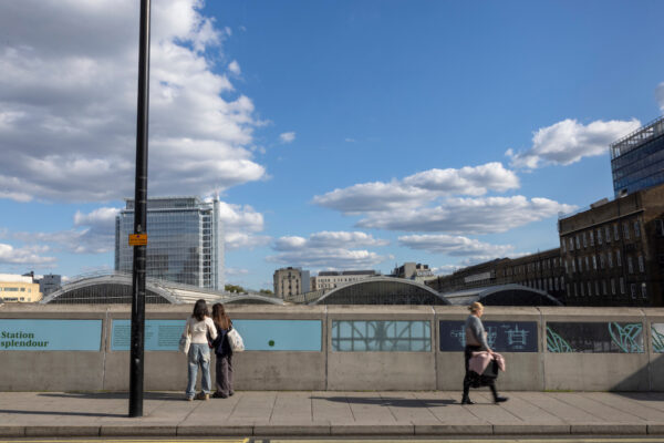
For the majority of passengers leaving Paddington Station (and the Elizabeth line station) Bishop’s Bridge Road is the connector between Paddington Station, Paddington Central, Little Venice, Merchant Square and the canalside. Its current layout presents severance and crossing the road is daunting for many pedestrians, even if they are not first-time users. Undertaken by 5th Studio, the study identifies a series of ideas including widened pavements, an additional pedestrian crossing, green infrastructure, improved lighting, dedicated provision for cyclists, creating new sightlines to the canal below and public art. Click here to read the full RIBA Stage 2 report.


Current Status
We continue to liaise with Westminster Council and Transport for London to bring forward safety improvements on Bishop's Bridge.
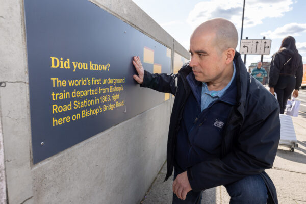
The National Express coaches have been moved from the bridge into Eastbourne Terrace. A series of heritage panels now animate four sections of the bridge.